
Services Offered
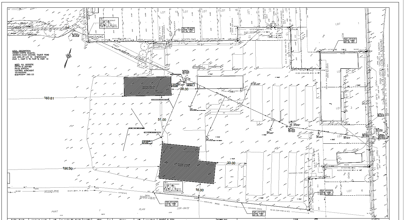
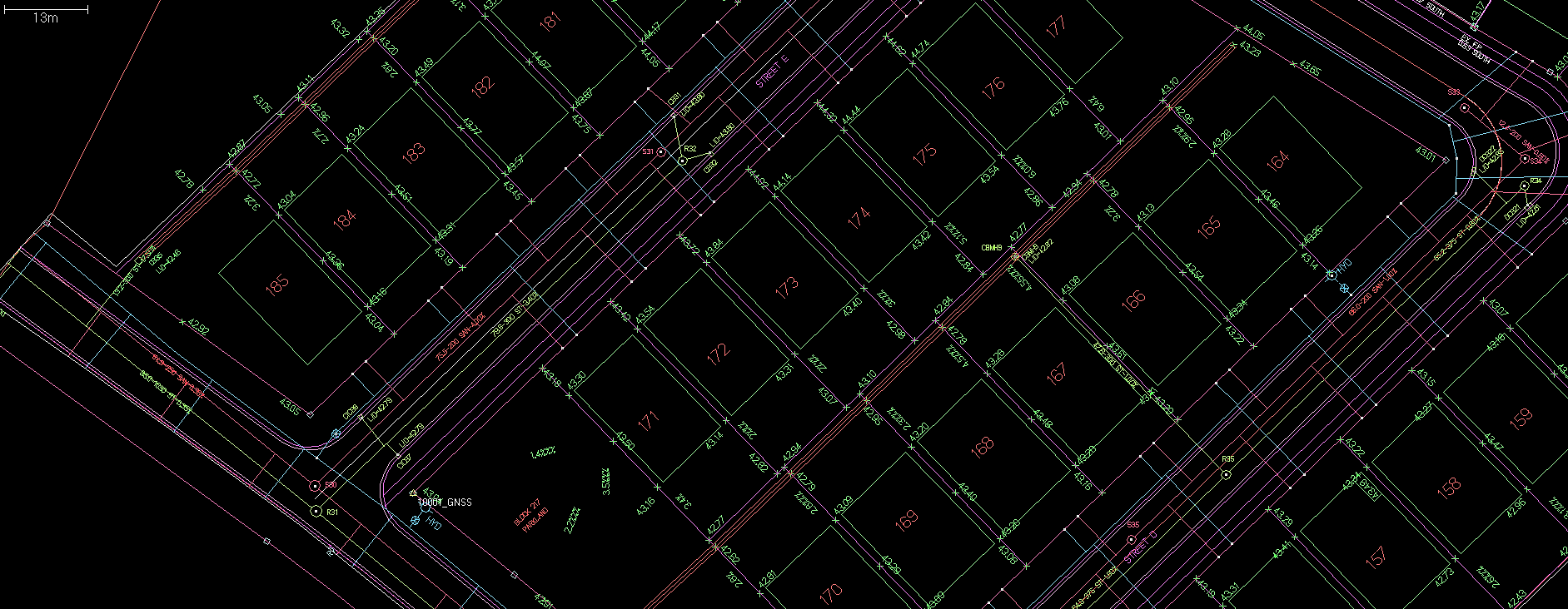
Construction Layout
- Subdivisions
- Roads
- City Streets
- Utilities (Gas & Electrical)
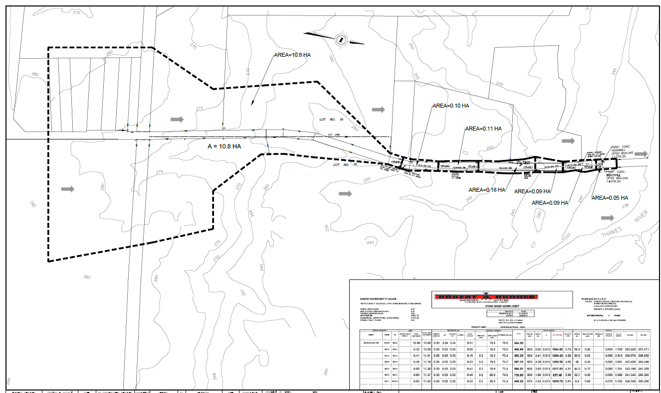
- Sanitary and Storm Sewers
- Catch Basins
- Watermains
- P.D.C.’s
- Curb and Gutter
- Round-About
- Bike Paths
- Storm Management Ponds
- Site Grading (All Stages)
- Design Build
Pre-Engineering Surveys
- Large Parcel Topography and Detail Surveys
- Small Parcel Topography and Detail Surveys
- Ulitility Information Gathering and Tie-Ins
- Exisisting Structure Foot Print Tie-Ins
- Water Sheds
- Roads and Entrances
- Existing Property Monuments
- Existing Fences, Trees Ditches
- Base Plan Generation in AutoCAD 3D with Contours
- Establish a Site Geodetic Benchmark
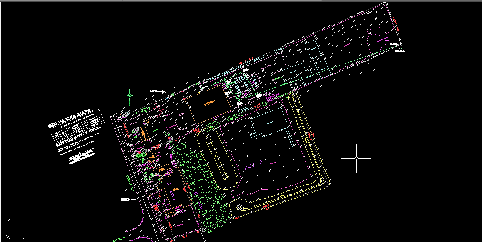
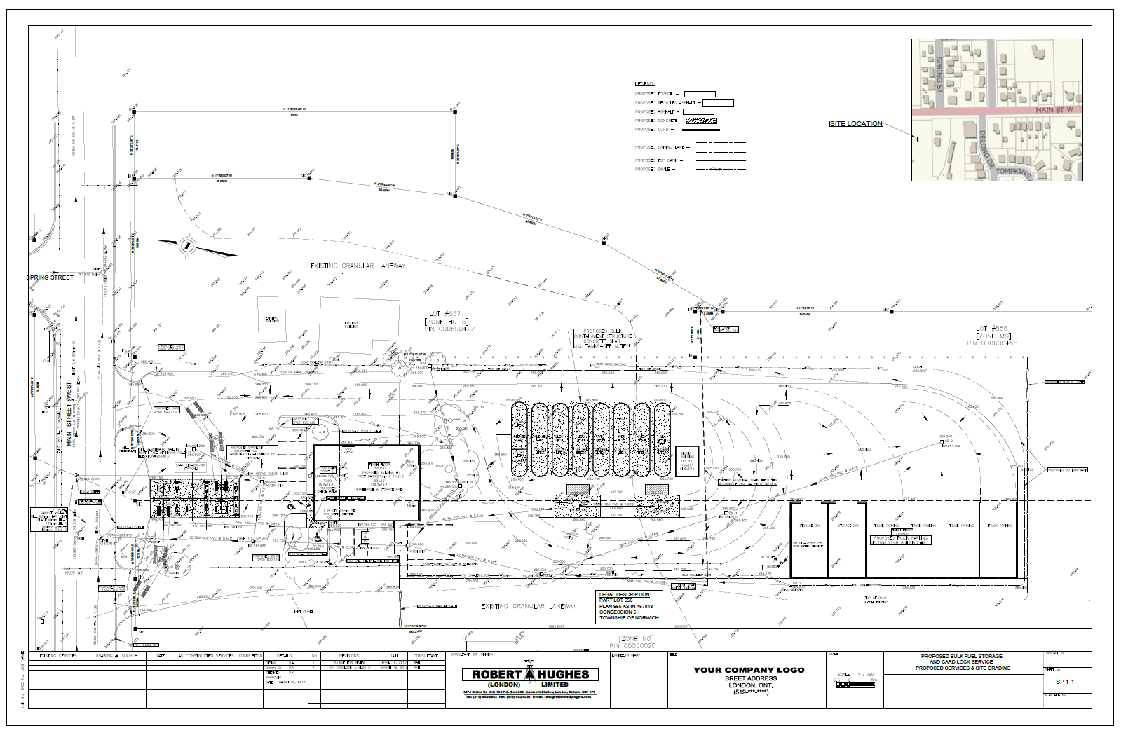
Site Plans
- Pre Engineering Survey
- AutoCAD File (Civil 3D)
- Provide Site Design
- Provide Storm Water Management data and sewer design
- Complete Drawing up to first Submission Stage
- Address Red Line Issues
- Re Submit with an Engineer’s Stamp for Final Approval
- Provide Site Layout as well if required
***NOTE: Our specialty is smaller site plans in the London and surrounding area.
We have experience in parking lots, car washes, and fuel card lock stations.
3D Machine Control
- Make One Field Visit for Site Horizontal & Vertical Control
- Establish a Field Site Control Working Point for the Base Station
- Working Point will be included in the 3D File
- Produce a Control File
- Produce a proposed Line Work File for all necessary Line work
- Produce a proposed DTM File for grading
- DTM File can include Granulars, Subgrades, Topsoil and specials
- Produce a proposed Point File for point layout-sewers etc…
- On-going support is Provided by us to ensure smooth work flow
- Volumes also can be provided if required
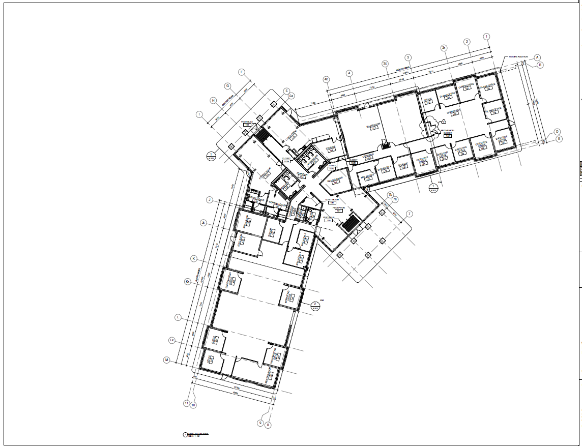
Structural Layout
- We will Acquire the Proposed Architectural Plans
- We will check and confirm all proposed distances
- The proposed building is plotted by ourselves onto the Site Plan
- We check and confirm that all Set back Requirements are met
- The building will then be laid out on site at desired offsets
- Piers can also be laid out and offset as well
- A site Bench Mark is provided
- A Proposed Finish Floor Elevation is also Provided
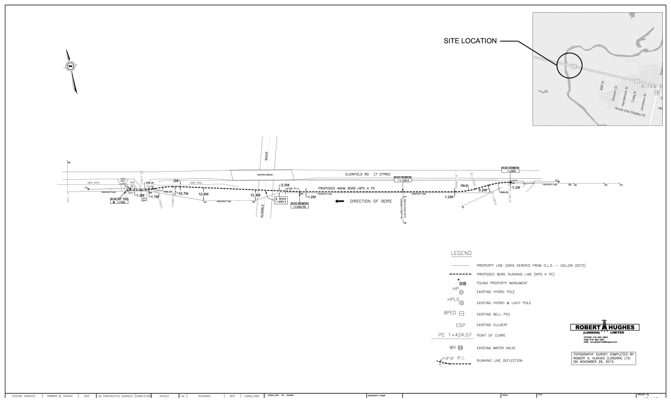
Utility Layout: (Bore Plans)
- Gather Existing Relevant Field Data
- Produce a Cad File of Existing Conditions
- Design a Proposed Bore Profile
- Bore Profile will be designed according to Proper Pipe bending Radii
- Plot final Bore Profile and complete a proposed site plan
- Final site visit to layout proposed pipe chainages for the construction
Site Design (Design Build)
- Usually required in Retro Fit Situations
- We will gather relevant site data in the field
- We will assess existing data and propose a plan on site
- The layout will then be completed in a timely fashion
- We will also ensure that the owner approves our plan
- These situations are usually regarding Grading or Alignment issues
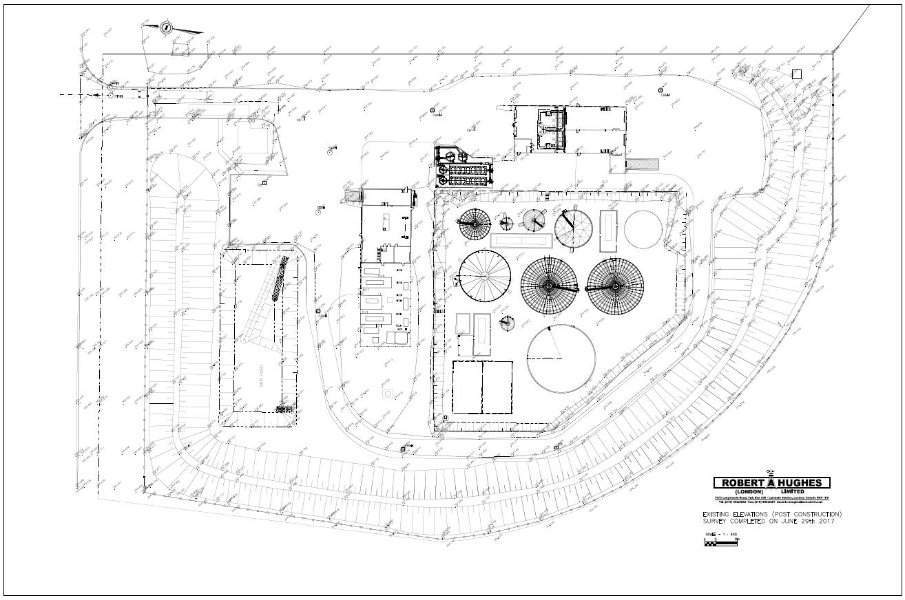
Topographical Surveys
- Establish scope of work
- Establish Site Horizontal & Vertical Control
- Acquire and tie in all property monuments
- Perform a site Topography Survey in a grid fashion
- We also ensure that all High and Low ground points are Captured
- Set a Site Geodetic Benchmark
- Finally we will produce a 3D Cad Base Drawing
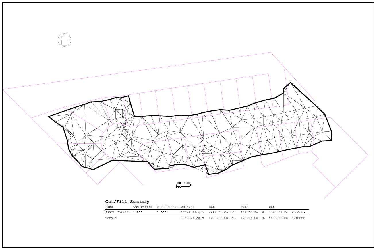
Quantity Surveys
- Earth moving Volumes for Payment
- Granular Volumes for Payment
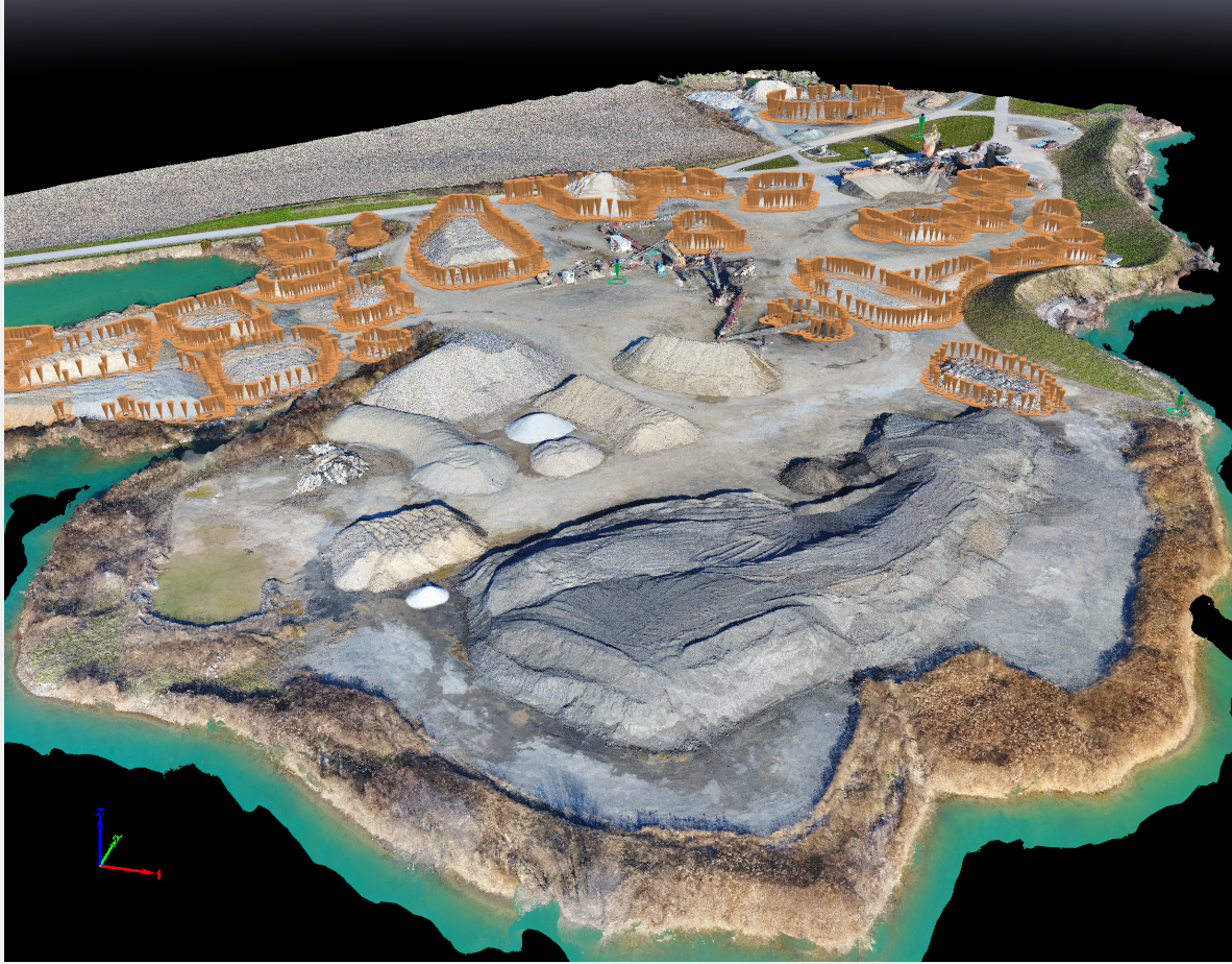
- Gravel Pit pile inventory surveys
- Supply cad File with Contours and Volume Data
On Site Problem Solving
- We have extensive experience with this
- Usually grading design issues or existing tie in issues
- We will assess and solve issues on site
- We will always work in an efficient and timely manner

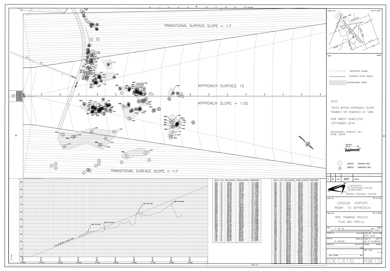
Airport Surveys
- Extensive knowledge with a wide range of surveys
- Runway Rehab layouts and Designs
- Linage Layouts and designs
- P.A.P.I. Layouts
- Electrical Layouts
- Approach Surveys
- Tree avoidance Surveys and solutions
- Taxi Layouts
- Apron layouts and designs
Drone Surveys
- We will perform Drone Surveys for many different situations
- We always use NAD 83-Zone 17 coordinate system
- Accuracy is: H=30mm & V=60mm
- Gravel Pit surveys for pile inventory and supply Volumes
- Large Parcel Topo surveys
- Disaster surveys requiring accurate data
- Provide all Jpeg picture Data and a 3D-CAD/ point cloud file
- We are fully licenced and insured as per the U.A.V. Federal Laws
Control Surveys
- Locate UTM Monuments
- Set control points for proposed projects from these monuments
- Control will be set to UTM NAD83 Zone 17 Coordinates
- Control can also be set with correct geodetic Datum as well
- Control can be provided in Grid or Ground Format
As Built Data Surveys
- Perform site survey capturing all installed site data
- Apply all site data onto an AutoCAD drawing
- Show all relevant descriptions and elevations for submission
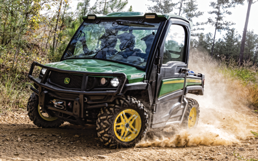
XUV Gator Surveys
- We own a JD 600 XUV with an attached RTK-GPS Unit and Data Collector
- This is usually used for large extensive surveys
- We have used this for topo surveys and large wind farm layouts
AutoCAD Drawings
- We can also provide Cad Drawings for Clients in the Civil Field
- We follow recommended drafting standards in all situations
- We can provide up to AutoCAD Civil 3D 2018 format

Wind and Solar Farms
- We have extensive experience in this field
- We have serviced many of these clients over the past years
- Invenergy
- Nextera
- Suncor
- Both Solar and Wind Energy
- Includes-Towers, Roads, Electrical, Bores, Culverts and Design Build